Crow Wing State Park

The Historic Beaulieu House in Crow Wing State Park 

The Drive: After driving for miles and miles on roads that are virtually empty, it is interesting how your conception of traffic changes. The drive from Savanna Portage to Crow Wing was mostly highway and it went through the busy vacation town of Brainerd.

I'm driving on cruise control and there is no one around. Perfect, I don't have to worry about anything. Then on the road way ahead of me, I see a solitary car. This is ridiculous, I think, I am going probably two mph faster than them so within the hour, I will be forced to pass them on this two lane highway. Then I see a car going two mph faster than me and even though they are a speck only visible behind me on long stretches of without curves, I feel as stressed as if someone were right on my tail. My entire driving experience is ruined and I can't think about anything except the inevitable moment when I'll actually have to be close to another vehicle. Of course, by the time I hit Brainerd, I'm back to my usual urban driving self and can once again zone out in the familiar security of highway traffic.

Boardwalk through the historic townsite of Crow Wing.

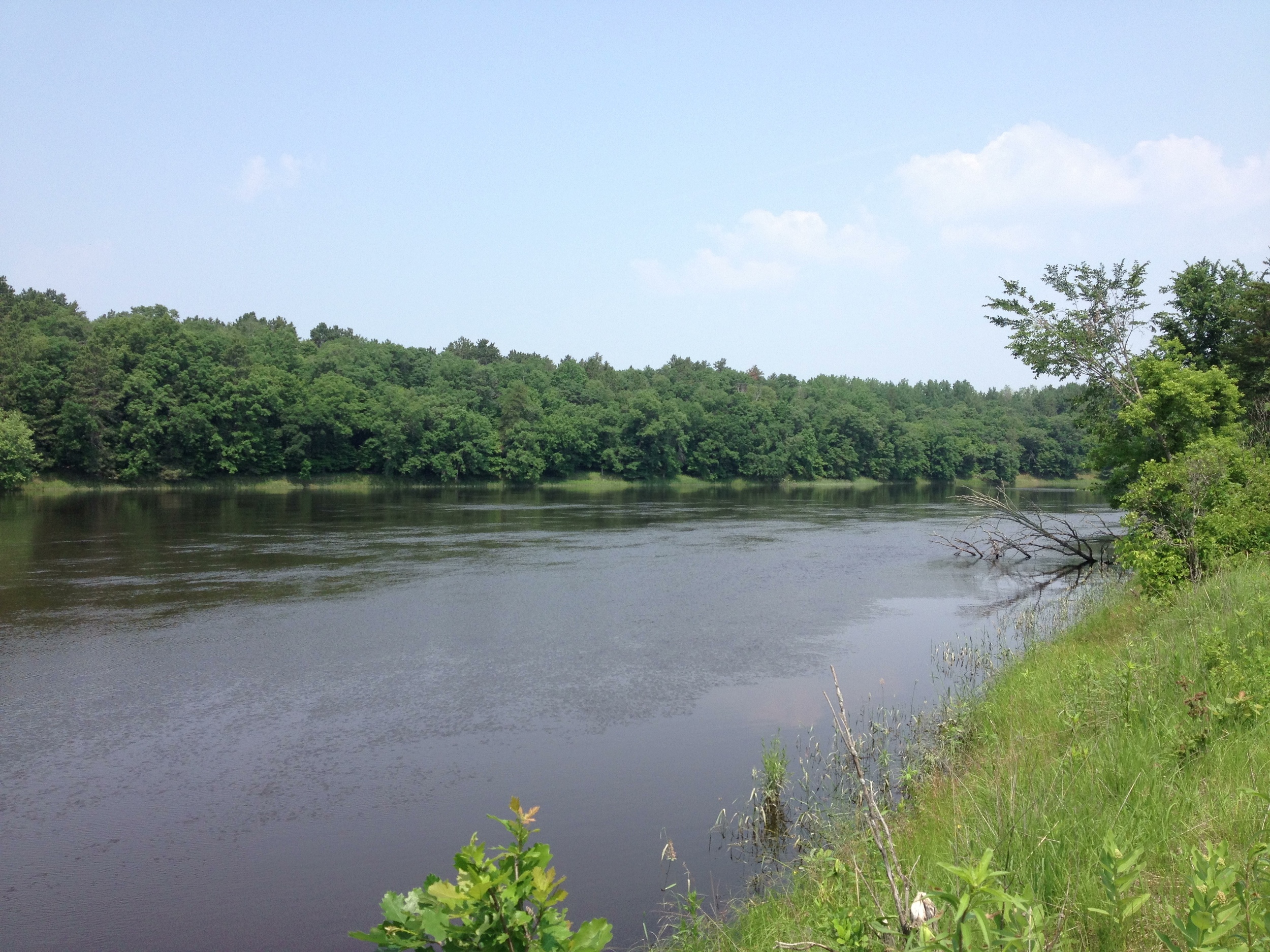
The Park: Situated at the confluence of the Crow Wing and Mississippi Rivers, Crow Wing State Park's biggest asset is its rich history as a town site and trading post on the Woods Route of the Red River Ox Cart Trail. The trail, which ran between Pembina on the Canadian, North Dakota, and Minnesota border and Fort Snelling, served as a major pre-railroad trading route through the state. Furs and agricultural goods traveled down in trains of up to a hundred oxcarts which purportedly sounded like a hundred untuned violins. It was said "a den of wild beasts cannot be compared with its hideousness." Despite the horrid cacophony that accompanied it, the oxcarts were the life blood of Old Crow Wing Village, bringing news, trade, and people to the otherwise isolated town. The tracks made by the oxcart can still be seen at the park over a hundred years after they became obsolete with the coming of the railroad.

Another view of the Beaulieu House in Crow Wing. The most photogenic structure in the park. 

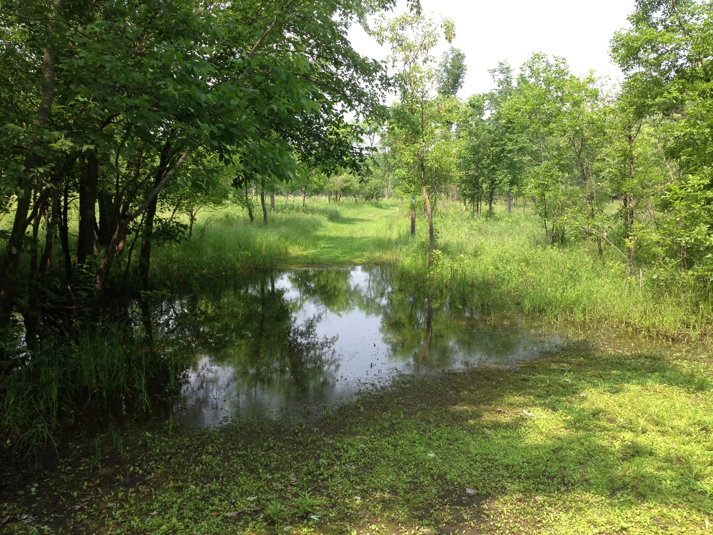
The Trail: The trail follows the old oxcart trail along the Mississippi through the townsite where you can see the historic Beaulieu House, the well site, and the locations of other important village buildings. It then climbs to the top of a bluff and gives a great (if mosquito infested) view of the confluence before wrapping around through a wooded path and back to the parking lot. The 2.3 mile trail also passes a cemetery and a historic mission site. It's a far cry from the wilderness hikes further north, but it makes up for it in history and culture, which, as a history major, suits me nearly as well. 

Cumulative Miles Hikes: 15.3

Cumulative Miles Driven: 527

Hike Type: Pine Forest, River, Historic

Arbitrary Rating: 4/5

Savanna Portage State Park

The mosquito infested pines of Savanna Portage State Park

The Drive: The drive went through what I can only describe as cabin country. Every hundred feet their is a rustic wooden signpost declaring the invariably Scandinavian name of the cottage's owners. Olson, Ericson, Nelson, Larsson, Carlson, Anderson, Andersen, Andersson. And just in case you didn't realize that Sven Bergson has Swedish heritage, his next sign will say Välkommen and bear a surprisingly unoriginal cherry red Dalecarlian horse. This theme climaxes as you tour the edge of Big Sandy Lake where pseudo-Scandinavian vacation communities manage to create a nostalgia for a time and place that arguably never actually existed. Beware, however, this can be dangerously endearing and if you're not careful, you may just find yourself nailing your very own rosemaled sign right next to Ole Bergström's. 

I normally love bogs, I do, but sometimes it's just better to avoid the fetid breeding grounds of one of planet earth's greatest scourges. 

The Park: Savanna Portage State Park is another pine/aspen mixed park that contained just enough maples to burst forth in glorious color come autumn. Straddling a continental divide (considering the noticeable lack of elevation, there are a surprising number of continental divides in this part of the state), this park feels remote. There is actually a section of the park officially named "Remote Solitude," although the fact that they had to name it may say something in itself. It fills my requirements of having loons, lakes, dead pine smell, and low light pollution that defines a northern park. The portage itself, which is part of the hiking club trail and connected the Mississippi water trails to Lake Superior via the St. Louis River, even adds a historical aspect, summoning up visions of voyageurs and crazy trappers. It really seemed like a perfect park, yet there was one think so overwhelmingly negative that I only gave the trail a 2 out of 5 on my Incredibly Arbitrary Trail Rating System.  

Remember that raptor scene in Jurassic Park 2 where the dino's picked off minor characters left and right as they crossed an open grassland? Replace raptors with vampiric, disease ridden insects, and you'll start to get the idea. 

The Trail:  I though I knew mosquitoes. Minnesota mosquitoes, I thought, aren't that bad. I've been outside in Minnesota my whole life. I'm tough, so I can handle anything. My bug spray will protect me. I knew that the mosquitoes were bad this year, but I thought I knew what I was up against. I was wrong. The Savanna Portage trail is 5.3 miles, the longest of the seven hikes I did on the aptly named mosquito route (which I named primarily because of this hike), and I decided to do it at dusk right after I arrived at the park. I bathed myself in my natural picaridin bugspray (actually not natural since picaridin is apparently just another lab produced chemical) and was off to what may very well be the most miserable experience of my life. 

The trail is a relatively strenuous one with steep inclines and drops into wet marshy areas, but the mosquitoes thrived everywhere. The pictures I took for this blog were literally paid for in blood because stopping long enough to snap an iPhone picture resulted in a solid layer of black insects on much of my exposed skin. They swarmed, buzzed in my ears, bit through my shirt and jeans like they weren't even there. Reapplying bug spray gave 5-10 minutes of relief, but they would soon be at it again. At one point, I considered just curling up on the side of the trail and letting them have me, but that didn't seem like the best solution for the problem. After all, you can deal with five miles of just about anything. Even if just barely so. 

Loons and fireflies help sooth the pain of the hike. 

I have to admit that my bug spray worked well. I probably got one bite for every thousand bugs swarming me. Since I exited that horrible hike with several hundred itchy red lumps forming like a constellation across my body, you can easily calculate the number of demons I had to deal with. I could barely enjoy the towering pine stands or appreciate the historical significance of the savanna portage section (which truly is a testament to my distraction). I barely even stopped to take a picture of a beloved bog which I passed though. I imagine this hike would have been fantastic in other circumstances, but just to be safe, I'm not going back to check until I can do it on snowshoes. 

Cumulative Miles Hiked: 13

Cumulative Miled Driven: 445

Hike Type: Pine Forest, Bog, Continental Divide 

Arbitrary Rating: 1/5 (see explanation)

The Mosquito Route 


Schoolcraft State Park

View of the not yet so mighty Mississippi at Schoolcraft State Park. 

The Drive: Moving out of the forest and into the farms. And that's all I really have to say about that.

The Park: Named for the famous "discoverer" of the Mississippi headwaters, Schoolcraft State Park is a small park situated on a marshy stretch of the Mississippi River surrounded almost completely by farms. Although it is supposedly known for its virgin forests and "elegant" water, the park has little to attract people except perhaps being the only natural area anywhere around. The park is clearly not a popular one since when I drove in on a Sunday afternoon in July, not only was I the sole hiker in the entire park, a park staff gave me a confused look from a distant building as if nothing could be more unexpected than an actual visitor.

Apparently this is a very old tree. That's worth something I suppose. 

The Trail: I quickly discovered why this isn't a haven for wilderness hikers. The trail is a short 1.8 mile loop that pretty much covers the entire park. You get a few pine trees, but nothing like the mature forests in the other parks, and a view of the river (as seen above). In fact, the two most exciting things I encountered in the park were a massive 300 year old white pine and a pretty cool mushroom, both of which could be viewed from the trailhead.

Can't say no to a good mushroom shot. 

But I will say this in favor of this park. So many state parks are built around an exceptional landmark, like a historic building, a pristine wilderness lake, or a rare ecosystem, but Schoolcraft embodies the space in between. If for no other reason, Schoolcraft is worth visiting to be reminded that you can enjoy a simple grove of pines and a large toadstool as much as any of the unique experiences the other parks might have to offer.

But don't go out of your way because this mushroom will probably be gone by the time you get there.

Cumulative Miles Hiked: 7.7

Cumulative Miles Driven: 366

Hike Type: Pine Forest, Deciduous Forest, River

Arbitrary Rating:2/5

The Mosquito Route

McCarthy Beach State Park

The Classic Minnesota Lake up at McCarthy Beach State Park

The Drive: When I asked Google Maps to guide me from Scenic State Park to McCarthy Beach, I was given two options. The first (which is the one on the map below) followed fast, well-maintained highways and estimated  the drive at an hour and fifteen minutes. The second mazed haphazardly through Chippewa National Forest, had a little hazard sign next to it, and, while actually shorter, estimated an hour and forty-five minutes. Naturally I took the second.

The first part of the drive followed the appropriately named Scenic Hwy 7 and Edge of the Wilderness Scenic Byway (no kidding, that's what it was called). I quickly covered about three quarters of the drive in forty five minutes and was skeptical that the last section would take an additional hour. Google obviously just underestimates my driving abilities. I turn off the highway and the pavement ends. No problem, won't even slow me down. Turn. The road narrows. Turn. The gravel ends. Turn. I'm now creeping along on a curvy, single lane forest maintenance road hoping no one is coming the other way. Questions begin to go through my mind. Why is this road here? What does that No Service signal mean on my phone? How does google even know about this road? Will anyone ever find my body? Google's time estimation turned out to be spot on and an hour later I emerge once again onto a paved road right at the entrance of McCarthy Beach.

A beautiful day for wilderness up at McCarthy Beach. 

The Park: Because I was just here for the hike, I didn't get to see a whole lot of the park other than the Hiking Club trail. I understand, however, that Sturgeon Lake has one of the nicest swimming beaches in the country (top 17 in North American according to Highway's Magazine as the website proudly boasts) and is known for walleye fishing (not sturgeon ironically). I can tell you the park felt more remote than any of the other state parks I visited. It was quiet, empty, and unspoiled. It had noticeably fewer mosquitoes than anywhere else and, most importantly, it was easily the best hike of seven I did on the Mosquito Route.

A good place to grab lunch next to the beaver lodge at McCarthy Beach State Park. 

The Hike: My Hiking Club booklet warned me that the trailhead is not easy to find, so I asked the friendly (and attractive) park ranger and she pointed me toward yet another minimum maintenance forest road with a warning to take the first trailhead "because the road starts to get bad after that." The 3 mile hike begins by leading down a hill to Pickerel Lake. With its loons, beaver lodges, wild irises, and sky blue water, Pickerel Lake is definitely the highlight of this hike. It has the simplicity and solitude you expect to find in a Minnesota lake, but so rarely do. Follow the Pickerel Lake Trail partially around the lake, then leave the the lake to head upland toward Big Hole Loop Trail. Take some time to check out the giant red and white pines along the upland portion before circling back to the lake. I had lunch on an easily accessible island in the far side of the lake and listened to the beavers trying to scare me off. Then it's back to the car and off to the next park!

Scenic State Park

The Minnesota Hiking Club Trail at Scenic State Park winds through the pines on this peninsula

The Drive: The drive from Minneapolis was long, but 169 is a reasonably pleasant highway, passing farms (where crops were noticeably late) and forests, small towns and tacky restaurants. It is only after Grand Rapids, when you leave the main highway, that the drive gets interesting. The road winds through Chippewa National Forest, a 700,000 acre forest (400,000 acres of which are actually lakes) in the heart of Minnesota. Largely undeveloped, the forest has some of the largest bald eagle, timber wolf, and (I would argue) mosquito  populations in the nation. With no other cars on the road, I meandered through this wilderness, taking a break at the Laurentian Continental Divide. More than any other place I visited on this trip, the forest smelled like wilderness (which to me is essentially dead pine needles diffused into flowing water and fresh air). I could have spent an entire weekend just exploring this two hour stretch of highway, but my destination couldn't wait and I had to get to the park before the office closed at 9:00.

Bog in Scenic State Park. My favorite ecosystem as this blog makes clear.

The Park: I picked Scenic State Park for the first hike in this series because it is one of the more remote parks and I was looking for somewhere I'd never been before. The park is the definition of a classic Minnesota get-away. The main lake is pristine, the shores completely undeveloped except for the swimming beach, and it is home to several pairs of loons who take it upon themselves to serenade campers to sleep every night. The red pines are old growth and there are a series of small bogs (!) scattered throughout the park.

The best part of my experience in Scenic, however, was the fireflies. I don't know if it always like this, or if I just happened to be there on a night of a wild mating frenzy, but the park was alight with fireflies. Not a moment passed when at least half a dozen glowing lights weren't suspended in the air, the scene perfectly reflected on the surface of the lake. And because the fireflies were all in pairs, burning as one, the lights were brighter than I'd ever seen them, an ever changing constellation that blended seamlessly into the night sky above.

The crystal clear water at Scenic State Park's Scenic Lake 

The Hike: The Minnesota Hiking Club trail range from 1 to 6.2 miles, so at 2.9 miles, Scenic's hike was right in the middle. The hike consists of two part. The first was a loop through a low lying forested area, part of which was a boardwalk over a bog. This may have been pleasant on a cooler day with fewer mosquitos, but I was anxious to get it over with. Despite soaking myself in repellent, the mosquitos still swarmed (not as bad as in other parks, but bad enough).

The second part of the hike is Chase point (hint: the password is on this section) and it was cool, open, beautiful, and bug free. Following the ridge of a long peninsula, the trail passes a small bog, where the pitcher plants were in bloom during my trip, then continues through a red pine forest with little undergrowth. It ends at a great overlook with a panoramic view of the lake (a great lunch spot as I found out). You then double back and follow the trail to your car. It was because of Chase Point that the Scenic hike got a 4 on my (admittedly arbitrary) Hiking Club scale.

Cumulative Miles Hiked: 2.9

Cumulative Miles Driven: 234

Hike Type: Forest, Lake, Bog

Rated: 4/5

The Mosquito Route